- Drifft Newsletter
- Posts
- Global mineral crush fuels prices, new tech, M&A, and jobs.
Global mineral crush fuels prices, new tech, M&A, and jobs.
Positioning to capturing opportunities in the mining boom
David Williams
November 06, 2023
David here. In the next 7 min, you’ll get:
💡What’s New: Mineral Rush Boosts Global Price Expectations, Tech, M&A, and Jobs.
🤔 Opinion: Positioning your resource startup with opensource AI.
🛠️ Tools & Data: Speed value creation and foster creativity.
Want to feature your service or product in DRIFFT? Grab an ad spot here.
Apologies for not posting last week while I was ill. Today’s letter will be a bit longer to cover what was missed.
💡What’s new
Geopolitics - Chinese mineral restrictions to the US take effect in early December. As a result, mines in North America are becoming economic and restarting operations. (An op-ed on the topic was just posted in the NY Times.) Meanwhile, China’s belt and road initiative continues with projected increases in Chinese mining interests to fuel its completion. All this development means the value of battery electric minerals is projected to rise sharply in coming years, sending many countries scrambling to secure their internal resources. Even Saudi Arabia is planning to mine and Finland is funding critical minerals discoveries. Nations that already produce, like Chile and Panama, are pausing to reconsider granting mining licenses–i.e., they’re nationalizing. It’s not all bad news: Developing economies rich in resources could enjoy more autonomy as their resources increase in value and help to reduce debt burdens.
“The demand pressure about to be exerted on copper producers in the coming years all but guarantees a market imbalance, resulting in copper becoming scarcer, and dearer, with each infrastructure initiative and with each ambitious green initiative rolled out by governments. It takes seven to 10 years, at minimum, to move a copper mine from discovery to production. In regulation-happy jurisdictions like Canada and the US, the time frame is more like 20 years.”
Technology - Any time a new way of seeing has been invented–telescopes, microscopes, x-rays–new industries emerge. That’s why I think this earth X-Ray system will deliver more than just minerals. Predicting the distribution of minerals under the ground would reveal some interesting things about our planet, not to mention making the job of down-stream mineral processing easier. Two other interesting developments worth mentioning: Earth AI announced a mineral discovery it claims is the first-ever of its kind using AI, and an Israeli group is using SAR satellite images to discover new mines.
In the background, AI foundation models in computer vision and natural language are powering productivity advances in complex analytics. For example, you can use LLMs in arbitrary geospatial applications and get a whole new experience. Interacting by voice will become commonplace, especially for VR and AR.
META is open-sourcing all the good stuff that OpenAI is charging for. It’s now trivial to integrate their models into earth observation workflows. Example: Geospatial AI foundation models–already on HuggingFace–allow anyone to take arbitrary multi-spectral satellite data and perform tasks such as flood mapping, wildfire scar segmentation, and crop segmentation. (And if you need training data, get it from NASA → ESRI or have a look at Umbra’s open dataset.) Using these models to generate and compare vector representations of geospatial data also has proven valuable.
Opensource is even conquering complex visualization tasks within the browser. Projects like GeoViews and Longboard are two notable examples that make rendering millions of vector data points trivial. Be sure to check out visualizing landscape changes using LiDAR.
Finance - There’s a big uptick in mining M&A activity, and the consolidation cycle is expected to continue at least into 2024. On the funding side, the future of tech development in mining looks like a combination of VC + government sponsorship to tackle the large risks and to entice venture investments. The government of Newfoundland, for example, is investing $4M in AI and junior minors. The overall level of funding for exploration has increased substantially over the past decade. All of that spending could mean opportunity for technology-focused startups.
Jobs and Learning - It appears the Scandinavians are exploring their own underwater mining reserves and filling new positions like this one. It has been suggested that in coming years there won’t be enough qualified people to perform mining operations in the West. So if you’re interested in becoming one of the few who can, you might consider learning peripheral computing topics that get you into resource companies. Carto’s “The State of Spatial Data Science” argues that your best bet is to focus on Python programming. You can explore uses of AI in mapping as there are a number of flashpoints in resource industries, like environmental monitoring, that could give you an edge. It’s trivial to get satellite data. But then you need to make the data speak. If you’re already in the mining industry, start learning these skills or you could find yourself training a replacement robot. Get an early start by learning how to utilize an AI robot training framework.
Regardless of where you’re starting, you probably want to snag the first edition of AI Applications in Mining. Some other recent gems to check out at the library:
In recent years I've realized data engineering is what much of my day to day work has become, but I've never formally studied the skills or stack. Using geospatial functions, OSM data, aerial imagery, and computational geometry inside of data pipelines is very unique for a typical data engineer.
🤔 Opinion
In the tech section above, I discuss the advances that opensource AI is delivering to geospatial disciplines, including resource exploration. There are several lessons I take from this development:
It demonstrates the importance of participating in open-source rather than attempting to develop only internal AI competency.
It strengthens my doubt about the business models of most geospatial AI companies focused on developing large AI models, even ones with proprietary data. The history behind Vicuna-13b and Falcon models taught me that its trivial to train on the output of proprietary models. More recently, CoPilot and GPT-4 took a hit with the release of StarCoder, an open LLM that performs as well as those models on coding tasks. That’s not to say the user experience will be the same as the paid versions. But community development will catch up quickly. Even the latest AI startups focused on queryable satellite imagery are being displaced, as this example from MSFT Planet shows.
It argues that resource startups should work with governments to develop their products. Why? Because jurisdictions with large budgets and resource deposits are going to seek to develop, for example, AI models that argue for increased volume / grade of resources. They’re in the business of generating tax revenue, usually by attracting investors and selling their land. If you’re launching a startup, it makes sense to identify these jurisdictions and request tax credits to start your R&D work in their backyards.
If you want advance notice of these opportunities, I am tracking. Subscribe below and send me a message: [email protected].
🛠️ Tools and Data
Extract high-resolution satellite data from Google Earth Engine and calculate Machine Learning-ready features for air pollution studies. | 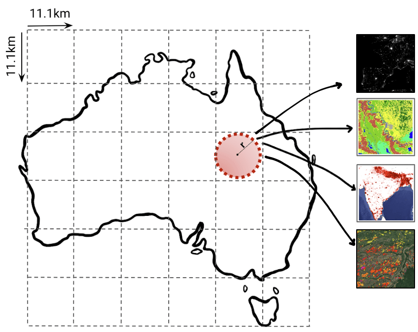 |
Extract, save and analyze input data of urban features from OpenStreetMaps. |  |
 |
LongBoard: https://github.com/developmentseed/lonboard Python library for extremely fast geospatial vector data visualization in Jupyter. |  |
Global Flood Mapper: https://github.com/PratyushTripathy/global_flood_mapper Demonstrates Google Earth Engine application for rapid flood mapping using Sentinel‑1 SAR. | 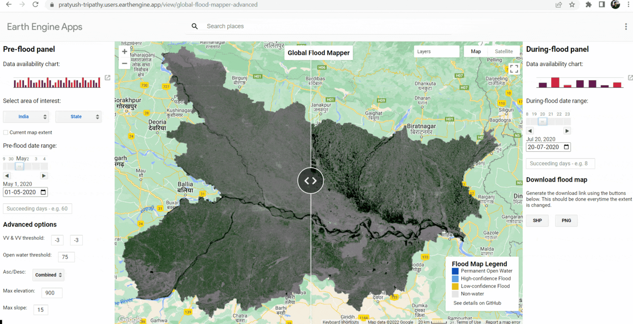 |
Landsat2 DEM: https://www.usgs.gov/landsat-missions/news/landsat-collection-2-dem-source-products-available Landsat2 Digital Elevation Model for earth, more accurate than previous versions. | 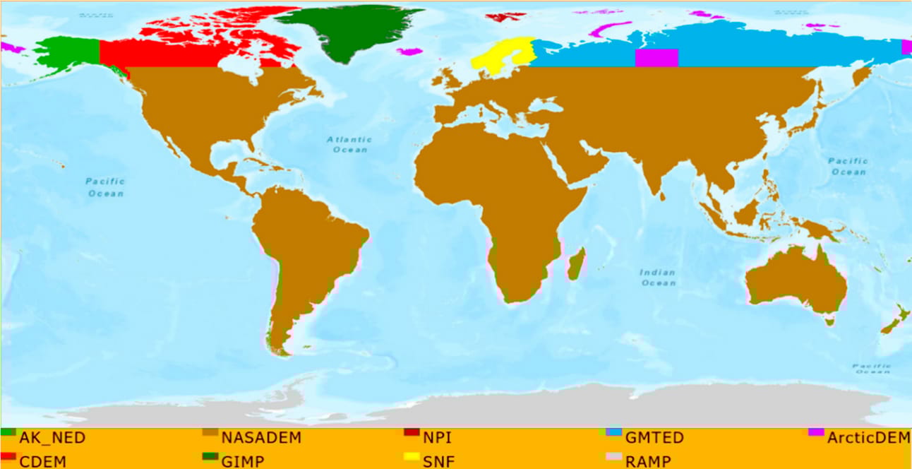 |
Satellite and drone object detection by Stephan Sturges. |  |
GPlately: https://github.com/GPlates/gplately Tool for modeling historical earth crust plate shifts for downstream analytics. |  |
Thanks for reading!